Jakob:
The sextant
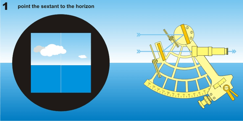
Sextant is an instrument for measuring angles. With it, you can measure how high the sun is in the sky.
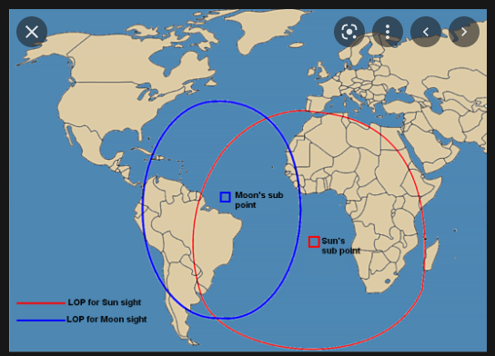
If you know the exact time of the measurement, you can calculate where on a circular line around the earth you are. By simultaneously measuring the height of another celestial body, e.g. the moon, you can get intersection points between the circles and you can conclude that you are at one of the intersection points. One can be excluded because it is on the other side of the world and the position is thus calculated.
Observations with sextant
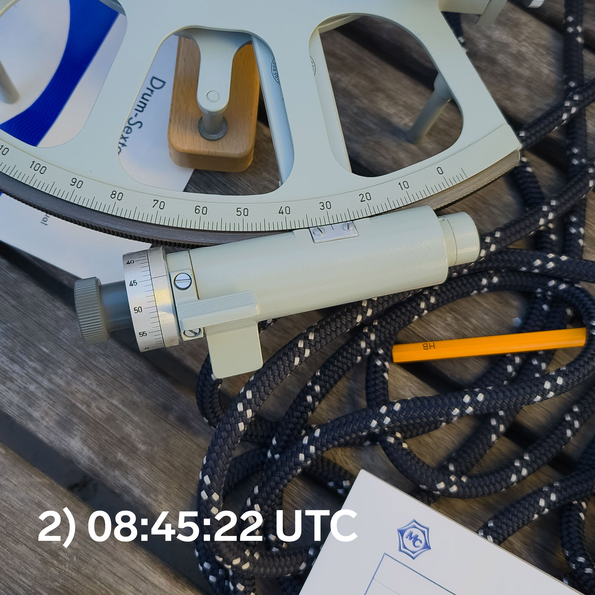
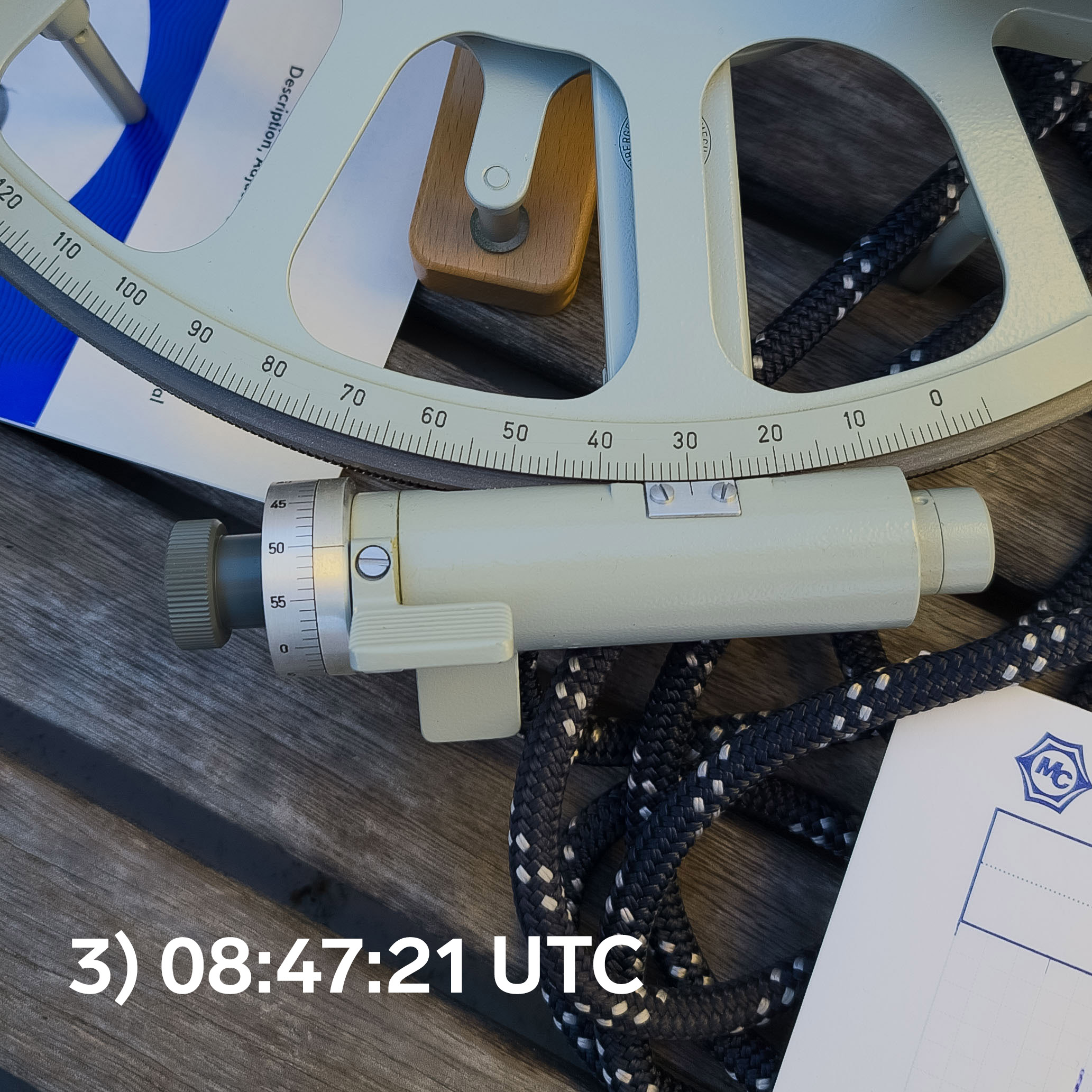
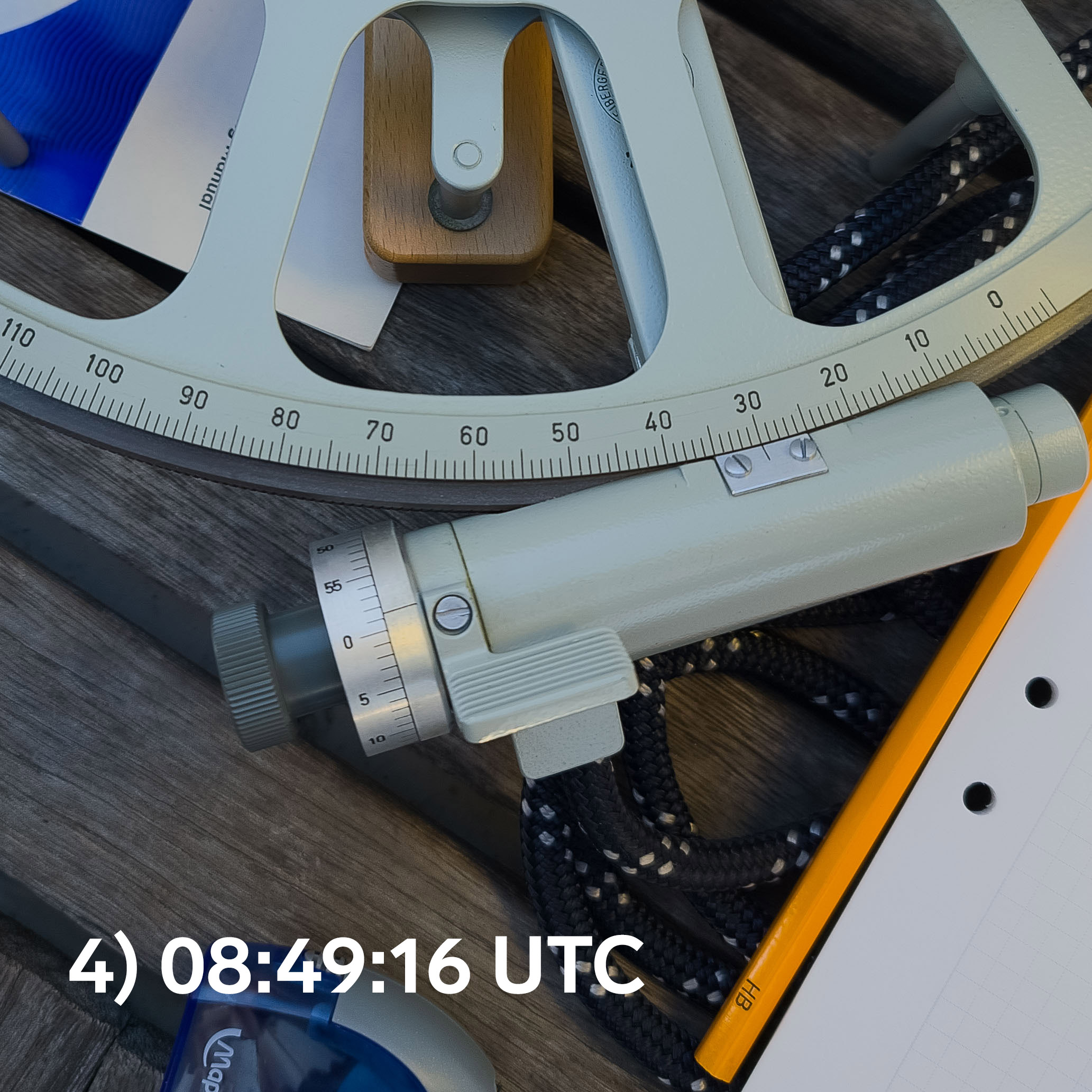
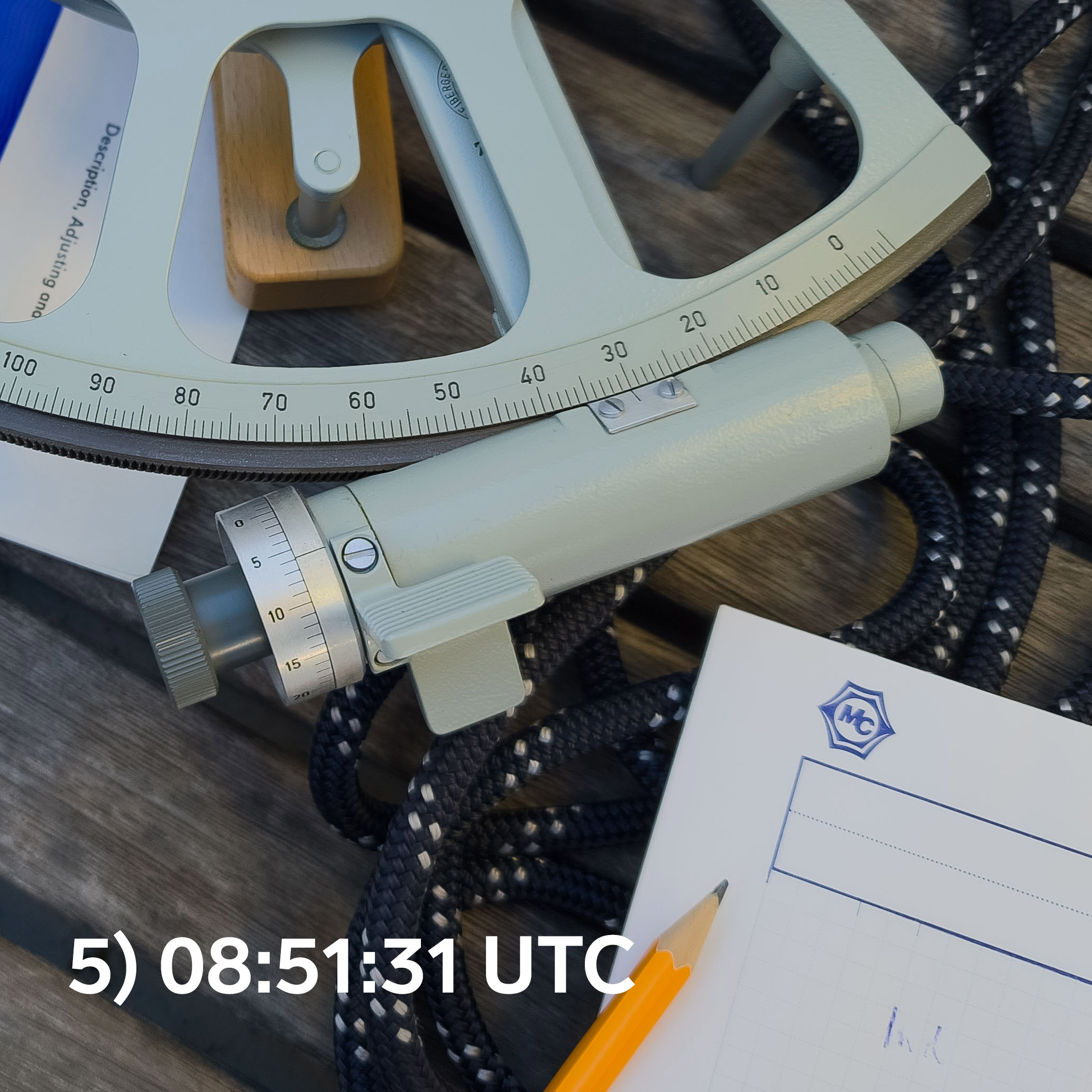
Last Sunday I sailed out to sea outside Holmsund to make the first observations with my newly purchased sextant. [Sunday sailing with sextant] I made five observations in close succession (10 minutes between the first and the last). It was calm and good weather but the boat rocked slightly. I sat in the cockpit and rocked along, trying my best to make good observations.
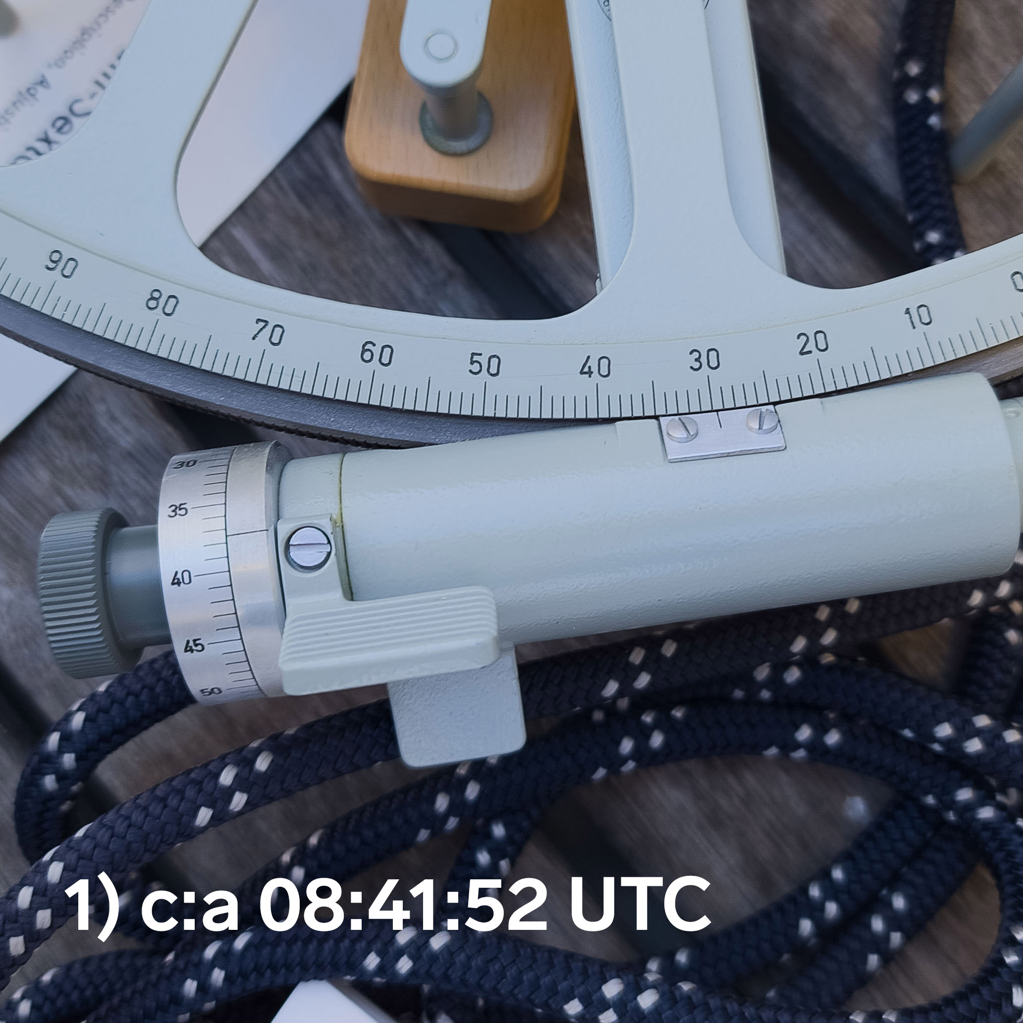
To help me, I had a stopwatch that I synchronized with the exact time from the GPS. At the first measurement I forgot myself and missed the timing, but the following four were timed with an accuracy of a couple of seconds.
After each measurement, I took a picture of the sextant's scale so that I could read it afterwards at home at my desk.
Finishing work
When I got home, I started counting. There are many courses and tutorials on the web - I followed e.g. this one. Traditionally, tables are used, partly a nautical almanac with the position of the sun hour by hour during the year, partly interpolation tables to cover second by second and great accuracy on the earth's surface. Tables can be downloaded here.
There are quite a few calculation steps to be carried out, so in order not to forget anything, it is good to use a form "Sight Reduction Form”.
It's a lot to keep track of if you've never done it before, and on the first few attempts I wasn't happy with the results. I knew I read the sextant well but the error was still too big. But after sleeping on the thing for a couple of nights, I found a couple of mistakes. When I recalculated I got it. Here are my completed forms.
The result of a solar altitude is actually a circular line around the earth, but on the small part of the earth that a regular chart covers, it basically becomes a straight line that can be drawn with a ruler. Here the lines (red) are plotted on an overview map.
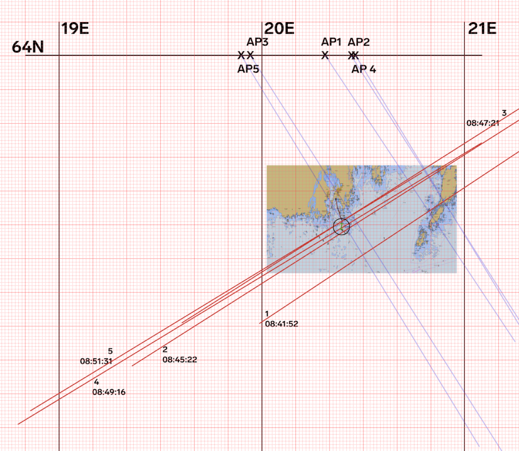
AP mean Assumed position, assumed position (a kind of guess to start from), you put it on a whole degree of latitude (64N)). From AP a calculated direction to the sun at the time of the measurement is drawn (light blue line) Azimuth Angle. On it, a perpendicular line is drawn at the distance Altitude intercept from AP. It is this line that is actually a circle around the earth.
If you look in detail at the chart around Holmsund outside Umeå, my calculated lines look like this:
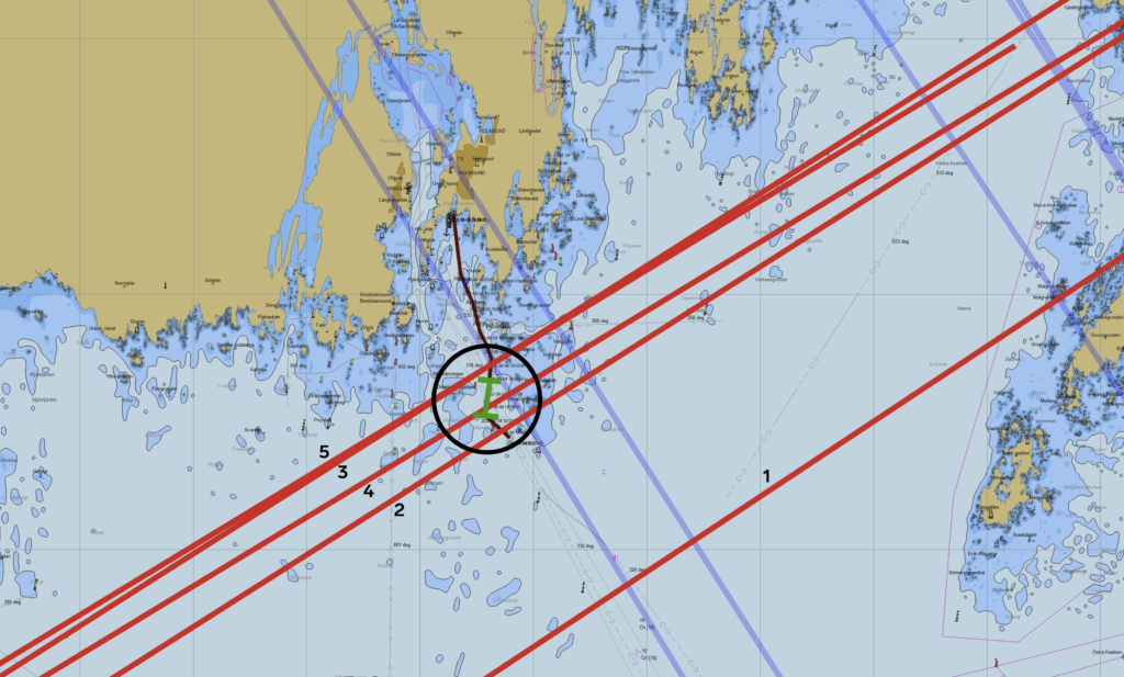
My route from Holmsund south is marked in dark red. The light green part is the passage where I made the sextant observations; it is about a distance minute long (2 km). The circle has a radius of 1 distance minute.
The line for observation 1, where I didn't have full control of the time, is apparently far too far south. On the other hand, 2-5 are well gathered within about a minute's distance from the observation site. I can be satisfied!
The result is much better than what is usually expected from a beginner and someone can certainly question how I managed this but there are a few things that I can defend myself with:
- I've spent a lot of time on the math of the sun's movements since I was a kid, so even though I've never held a sextant before, I'm hardly a complete novice.
- As an engineer, I am used to measuring carefully and assessing the accuracy of measurements and calculations.
- I documented the sextant's setting with a photo to be able to read it afterwards, in peace and quiet.
- I had the time and opportunity to be thorough and accurate.
On Saturday I'm going out again to take new sun heights. Then it will be up to proof. And it is important to train the speed and to also have time to do the calculations out at sea before you have time to sail too far from the observation point.