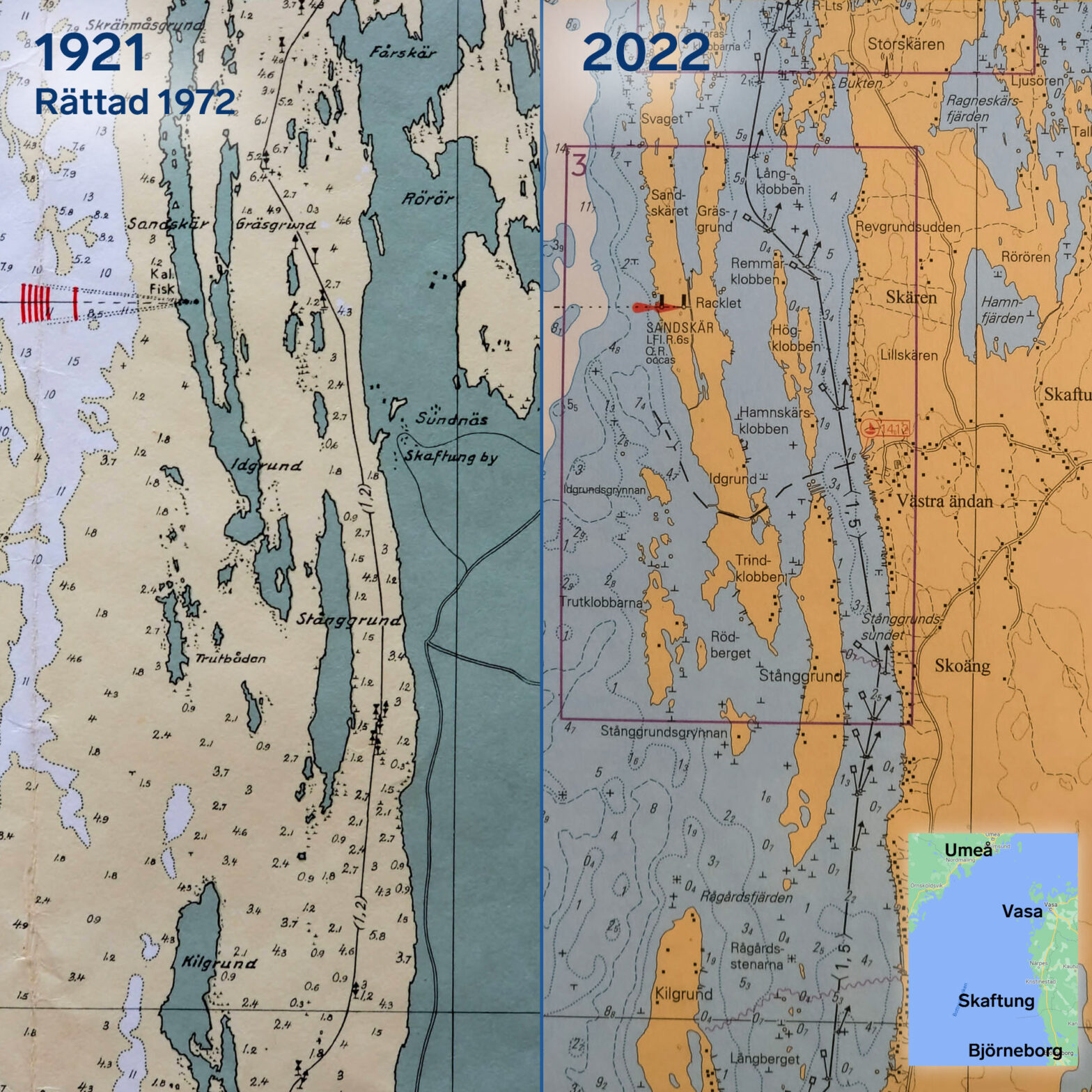
We had no shortage of charts on our trip to Finland. In addition to the chart plotter and new boat sports cards, we had the cards from the first Turid in reserve. They were from 1972, so bought 50 years ago, but in fact drawn much earlier. The cards around Kristinestad were e.g. drawn in 1921, 101 years ago.
The Finnish Bothnian coast is very shallow and rocky and the land uplift is strong. Therefore, it is interesting to compare the old and new cards. I chose a section from Skaftung south of Kristinestad, the shallowest passage during our trip. See the picture. In the Skaftung area, land elevation is around 75 cm in 100 years.
Our fairway is marked 1.5 m. This means that boats with a draft of 1.5 m should be able to pass with a margin. On the 1921 map, the fairway was marked 1.2, even though it should have been deeper at the time. Maybe they have since found a better route, maybe they have moved some stones that were in the way.
A lot has happened to the islands between the two chart versions. They have risen out of the sea; they have grown together. But the fairway is thus deeper today than 100 years ago.